Geography Climate
Aklavik is a town in Inuvik Region of the NWT. It is situated in the delta of the Mackenzie River, near the Richardson Mountains and the Arctic Ocean. Aklavik's geographical coordinates are approximately 68°13′N 135°00′W.
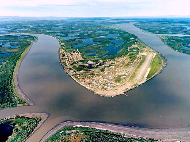
Aklavik is a town in Inuvik Region of the NWT. It is situated in the delta of the Mackenzie River, near the Richardson Mountains and the Arctic Ocean. Aklavik's geographical coordinates are approximately 68°13′N 135°00′W.
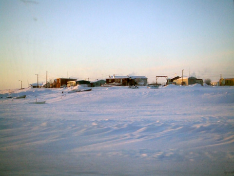
Aklavik has a subarctic climate (Köppen climate classification: Dfc). Winters are long, cold, and snowy, while summers are short and mild. The average low temperature in January, the coldest month, is around -30.2°C (-13°F), and in July, the warmest month, the average high temperature is around 18.4°C (57°F). The town experiences a significant temperature range throughout the year. Aklavik's precipitation is relatively low, with an average annual precipitation of around 266 mm (10.5 inches). Snowfall is common from October to April, while the summer months receive more rain. Due to its location in the Arctic region, Aklavik experiences polar day (24-hour sunlight) during the summer months and polar night (24-hour darkness) during the winter months. The midnight sun is visible from early June to mid-July, while the polar night occurs from early December to early January.